


How Drones Are Used for Mapping
Drones have fundamentally transformed the field of mapping by providing high-resolution, cost-effective, and highly efficient solutions across various industries. Unlike traditional mapping methods, which often require extensive time, manpower, and expensive equipment, drones offer a more accessible and technologically advanced alternative. By seamlessly integrating advanced imaging technology, GPS, and LiDAR sensors, drones have made it possible to capture and analyze geographic data with remarkable precision. Whether for construction projects, environmental monitoring, or urban planning, drones are redefining the way maps are created and utilized.
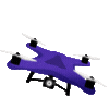
The Role of Drones in Mapping
Drones, also referred to as Unmanned Aerial Vehicles (UAVs), are equipped with state-of-the-art technology that allows them to capture highly detailed aerial imagery. These devices are commonly fitted with high-resolution cameras, GPS receivers, and LiDAR sensors, all of which work together to generate precise and accurate maps. Unlike traditional ground-based surveying methods, which can be time-consuming and labor-intensive, drones can cover vast areas in a significantly shorter amount of time, making them an invaluable tool in modern mapping applications.
One of the key advantages of using drones for mapping is their versatility. They are widely utilized across a range of industries, including land surveying, agriculture, real estate, disaster response, and infrastructure development. For instance, in agriculture, drones help farmers monitor crop health by capturing high-resolution images that reveal patterns of growth and areas in need of attention. Similarly, in real estate and urban planning, drone-generated maps provide detailed aerial views of properties, helping developers make more informed decisions regarding land use and construction.
Furthermore, drones play a crucial role in disaster response and recovery efforts. After natural disasters such as hurricanes, earthquakes, or wildfires, drones can be deployed to quickly assess damage, identify hazardous areas, and assist emergency responders in planning relief operations. Their ability to provide real-time data and generate detailed topographical maps helps authorities make faster and more effective decisions during critical situations.
Overall, drones have not only enhanced the efficiency of mapping but have also expanded the possibilities of what can be achieved in various fields. As technology continues to advance, the capabilities of drones in mapping applications will only continue to grow, offering even more precise and valuable insights for industries and communities worldwide.
Types of Drone Mapping Technologies
-
Photogrammetry
- Captures multiple overlapping images of the ground.
- Uses software to stitch the images into a detailed 2D or 3D map.
- Ideal for construction sites, real estate, and environmental studies.
-
LiDAR (Light Detection and Ranging)
- Uses laser pulses to measure distances and create highly accurate 3D terrain models.
- Penetrates dense vegetation, making it useful for forestry and topographic surveys.
-
Thermal Imaging
- Uses infrared cameras to detect heat signatures.
- Helps in detecting structural weaknesses, monitoring crops, and disaster relief efforts.
Applications of Drone Mapping
-
Construction and Infrastructure
- Drones provide real-time progress tracking and site surveys, reducing the need for manual inspections.
-
Agriculture
- Farmers use drone-generated maps to monitor crop health, detect irrigation issues, and optimize yields.
-
Urban Planning and Real Estate
- Provides 3D models of properties and land plots, helping developers visualize projects before construction.
-
Disaster Management
- Drones quickly map affected areas, providing critical data for search and rescue operations.
-
Environmental Conservation
- Helps track deforestation, wildlife populations, and coastal erosion with high-precision mapping.
Choosing the Right Drone for Mapping
- DJI Phantom 4 RTK – Great for survey-grade accuracy.
- DJI Matrice 300 RTK – Advanced mapping with LiDAR capabilities.
- Parrot Anafi USA – Compact and suitable for commercial mapping.
Conclusion
Drones have transformed the mapping industry, providing accurate, high-resolution, and cost-effective mapping solutions across various sectors. As drone technology continues to evolve, their applications in mapping will expand further, offering even more efficiency and precision.