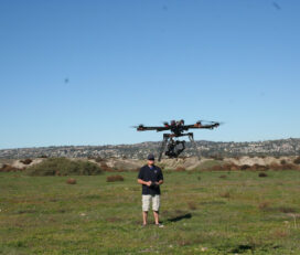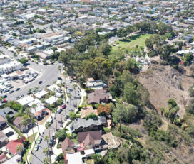


Professional photogrammetric mapping and imagery services for a variety of industries to governmental, engineering, and developmental organizations throughout the United States, Mexico, and Canada.
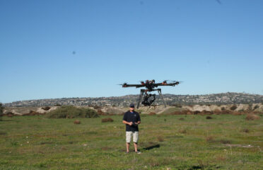
With leading-edge technology and an experienced team of aerial mapping professionals, Photo Geodetic provides aerial surveying for projects ranging from land subdivision and mining exploration to tunnel building and construction.
Dedicated to putting people first and delivering practical, cost-effective, aerial surveying solutions.
– Mapping
– LiDAR
– GIS
– Orthophotography
– Large-Scale Printing & Plotting
– Scanning
– Conventional Survey
June, 2025
Sunday
2:30 am - 3:00 am
3:00 am - 3:30 am
3:30 am - 4:00 am
4:00 am - 4:30 am
4:30 am - 5:00 am
5:00 am - 5:30 am
5:30 am - 6:00 am
6:00 am - 6:30 am
6:30 am - 7:00 am
7:00 am - 7:30 am
7:30 am - 8:00 am
8:00 am - 8:30 am
8:30 am - 9:00 am
9:00 am - 9:30 am
9:30 am - 10:00 am
10:00 am - 10:30 am
10:30 am - 11:00 am
11:00 am - 11:30 am
11:30 am - 12:00 pm
12:00 pm - 12:30 pm
12:30 pm - 1:00 pm
1:00 pm - 1:30 pm
1:30 pm - 2:00 pm
2:00 pm - 2:30 pm
2:30 pm - 3:00 pm
3:00 pm - 3:30 pm
3:30 pm - 4:00 pm
4:00 pm - 4:30 pm
4:30 pm - 5:00 pm
5:00 pm - 5:30 pm
5:30 pm - 6:00 pm
6:00 pm - 6:30 pm
6:30 pm - 7:00 pm
7:00 pm - 7:30 pm
7:30 pm - 8:00 pm
8:00 pm - 8:30 pm
8:30 pm - 9:00 pm
9:00 pm - 9:30 pm
9:30 pm - 10:00 pm
10:00 pm - 10:30 pm
10:30 pm - 11:00 pm
11:00 pm - 11:30 pm
11:30 pm - 12:00 am
August 26,2019
Awesome Job!
We have received your appointment and will send you a confirmation to your provided email upon approval.
 Own or work here?
Claim Now!
Claim Now!
Own or work here?
Claim Now!
Claim Now!

/ Per Listing
Lorem ipsum dolor sit amet, lorem sit.
/ Per Listing
Lorem ipsum dolor sit amet, lorem sit.
Claim request is processed after verification..